


Scientists are creating a radar that observes storms with new intensity and precision, the National Science Foundation announced this month. The hope, researchers said, is that the technology will transform the future of forecasting — before hurricanes and tropical cyclones get worse.
If all goes to plan, the system — called Airborne Phased Array Radar — will sit on Hurricane Hunter planes as they barrel into the eye of a storm. And it represents the latest in a relentless national effort to understand and track weather that is more powerful — yet less predictable — than ever.
The Airborne Phased Array Radar, or APAR, is a “major improvement” over the current systems, said Wen-Chau Lee, a senior scientist at the National Center for Atmospheric Research who came up with the radar idea 22 years ago.
“The goal is to reduce the uncertainty of the forecast,” he said.
The concept is simple. More data means better predictions, which means in the future scientists may be able to issue hurricane evacuation warnings for specific areas, instead of a whole coastal region.

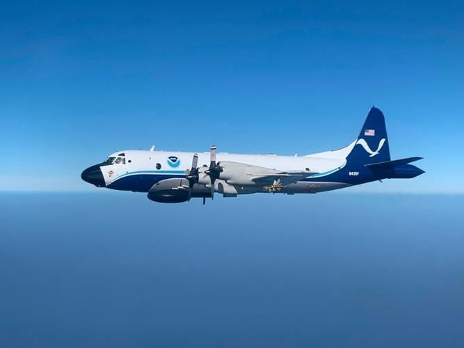
A US Air Force WC-130J Super Hercules of the 53rd Weather Reconnaissance Squadron, coasts over Southern University Thursday evening, May 18, 2023, while performing a training exercise. The specialized unit, also known as Hurricane Hunters, is a component of the 403rd Wing located at Keesler Air Force Base in Biloxi, Miss. and is the only operational unit in the world flying weather reconnaissance on a routine basis.
The science is more complex. Hurricane Hunter planes today measure weather through tail Doppler radars that collect cross sections of data that researchers piece together to create 3D images of a storm. The new APAR radar will collect 3D views from deeper inside storm clouds. At the same time, it will measure vaporization — an important metric that can indicate how fast a storm is growing.

An average number of storms is forecast for this year, but there is significant uncertainty. State officials are urging preparations -- and to not rely on contraflow.
“It’s just a different wavelength of radar,” said Jonathan Shannon, a public affairs specialist at the National Oceanic and Atmospheric Administration. “We’re hoping it will give us the ability to look even deeper to understand all the forces and components of a tropical cyclone or hurricane.”
The radar first will fly on a NCAR test plane. Shannon said NOAA would like to fly the radar on a C-130J aircraft by 2030.
It is unclear whether the technology, which is still about five years from use, would also be adopted by the Air Force Reserve 53rd Weather Reconnaissance Squadron Hurricane Hunters in Biloxi. That squadron uses different planes than NOAA, and a spokeswoman said they are currently working to install wifi on planes so they can send data to the ground at faster speeds.
The National Science Foundation announced a $91.8 million funding plan for the new radar this month. Hurricane Hunters from NOAA and the Air Force have long flown into storms on research and reconnaissance missions, respectively, and scientists say the new radar will make it easier to predict the patterns of storms from tornadoes to major hurricanes.
The funding and radar plan was announced June 1, on the official start of hurricane season.

A US Air Force WC-130J Super Hercules of the 53rd Weather Reconnaissance Squadron, coasts over Southern University Thursday evening, May 18, 2023, while performing a training exercise. The specialized unit, also known as Hurricane Hunters, is a component of the 403rd Wing located at Keesler Air Force Base in Biloxi, Miss. and is the only operational unit in the world flying weather reconnaissance on a routine basis.

