


Another hurricane season arrives on Thursday, and forecasts are being rolled out with insightful analysis of weather patterns in the months ahead. But here’s the bottom line for Louisianans who’ve seen too much destruction: Nobody really knows anything.
At least nothing definitive. There are certainly indicators that provide a reasonable basis for seasonal forecasts, ranging from El Nino to warmer-than-usual sea surface temperatures, pointing to an average or slightly below average number of storms. Technological improvements are also allowing for better warning systems when hurricanes do form.
But no matter the forecasts, Louisiana’s coast is always at risk of being hit by a strong hurricane. And as everyone from the nation’s foremost weather experts to your neighbor down the street will tell you, it only takes one.
That’s why Louisiana officials are working to get the word out now that preparations are in order. Plot out an evacuation route that takes you north and don’t expect to rely on contraflow. Review your insurance coverage. Know how you’re going to care for elderly or sick relatives.
New Orleans’ new $14.6 billion levee and floodwall system is a vast improvement over pre-Katrina defenses, but it will not protect against all storms. The Army Corps of Engineers has in the meantime been investigating pump corrosion in a key part of that system, but it has made contingency plans and says it will have more than enough capacity in place to pump out rainfall.
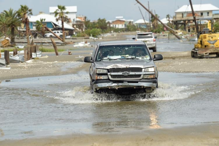
This season, which runs through Nov. 30, is also arriving as families continue to recover from the brutal years of 2020 and 2021 – a span that saw two of the most powerful storms to ever make landfall in the state in Hurricanes Laura and Ida, both Category 4 monsters with 150 mph winds. Laura ripped through southwest Louisiana in 2020 and Ida leveled parts of the southeast in 2021.
Hurricanes Delta, a Category 2, and Zeta, a Category 1, also hit during that timeframe. Last year was mercifully quiet for Louisiana, but residents need only to look east to where many spend their summer vacations for reminders. Hurricane Ian plowed into southwestern Florida as a Category 4, left behind around $112 billion in damage and killed more than 150 people, directly or indirectly.
Ian was the third-costliest U.S. storm on record, trailing Hurricane Harvey at No. 2 and Katrina as the costliest ever at $193 billion, adjusted for inflation. Ida is sixth at $81 billion.
“There’s a tremendous amount of recovery ongoing, and communities may be more vulnerable or have challenges relative to that recovery that puts them in a posture to make it even more important that we do our very best to be prepared,” said Casey Tingle, director of the Governor’s Office of Homeland Security and Emergency Preparedness.
“And certainly we know that that's true for families across the state that may still be struggling with insurance or other things on the recovery side and having to deal with a blue roof perhaps, or living in a travel trailer or mobile home.”

A humorous sign on the marquee of the Lake Pontchartrain Causeway in anticipation of Hurricane Ida in Metairie, Friday, Aug. 27, 2021. (Staff photo by David Grunfeld, NOLA.com | The Times-Picayune | The New Orleans Advocate)
A rare and average year?
Forecasts this year have taken into account some important changes in weather patterns. For the past few years, a La Nina pattern has been in place, and that has contributed to extremely active storm seasons. La Nina has now ended and El Nino is expected to be in place this year.
Their effects on hurricane season have mainly to do with wind shear. La Nina leads to less wind shear in the Atlantic, which is favorable to hurricane formation.
El Nino does the opposite. It leads to more wind shear in the Atlantic, and that essentially chops across storms and can prevent hurricanes from forming. Still, there are no guarantees, and strong hurricanes do form in El Nino years.
Take Hurricane Betsy in 1965, which many New Orleanians will remember – or at least have heard stories about. That storm occurred in an El Nino year.
Balancing out El Nino in forecasts this year are other factors, including warmer-than-normal sea surface temperatures in the Atlantic and Caribbean, which can help feed storms. As NOAA scientists explained last week, those warm temperatures are due partly to a long-term weather cycle known as the Atlantic multidecadal oscillation, which usually lasts between 20-40 years.
A warm pattern that began in 1995 is continuing, while temperatures in general are also gradually rising due to global warming.
The clash of factors has led to significant uncertainty in this year’s modeling, NOAA scientists say. With all that in mind, here are some of the main aspects of this year’s forecasts:
- NOAA forecasts a “near-normal” year, with 12-17 named storms, five to nine hurricanes and one to four major hurricanes of Category 3 and above.
- A closely watched forecast from Colorado State University predicts a slightly below-average year, with 13 named storms, six hurricanes and two major hurricanes.
- An average year includes 14 named storms, seven hurricanes and three major hurricanes, based on a 30-year history between 1991 and 2020.
- Because of recent highly active years, this year's "near-normal" forecast would have been considered a more active season a decade ago.
“We've had anywhere from six named storms to 18 named storms during El Ninos,” said NOAA’s Matthew Rosencrans. “The stronger an El Nino event, usually the less amount of storms you have. But we are also in an active era, and having a strong El Nino with an active era and such warm (sea surface temperatures), I've only seen it one other time in the historical record. So there’s not a lot of analog evidence for it. So it's definitely kind of a rare setup for this year.”

Wind and water damage caused by the path of Hurricane Ida Tuesday August 31, 2021, in Larose, La.
Don’t rely on contraflow
One piece of advice state officials are stressing has to do with contraflow – specifically, not to rely on it. Due in part to the increasingly rapid intensification of storms, contraflow is often not a viable option for Louisiana.
There is a checklist of factors that must be met before the state can employ contraflow, or shifting all lanes of highway traffic in the same direction, according to the state Department of Transportation and Development. Prerequisites include New Orleans and the metro parishes calling for a mandatory evacuation and a slow-moving Category 3 storm or higher in the Gulf.
The decision to use contraflow must be made 72 hours in advance, and preparation for it is extremely burdensome. Equipment to shut off hundreds of intersections and direct traffic must be set out and engineers must reprogram traffic lights. The state must also complete evacuations from pickup points and coordinate with other states.
Implementing contraflow outside of that checklist can cause more harm than good since it severely limits transportation options, state officials say. It has not been used since Hurricane Gustav in 2008.
“You can't just run up to your local grocery store and buy contraflow off the shelf,” said DOTD spokesman Rodney Mallett.
The state is also urging people to leave early, drive north and look for alternative routes when they do evacuate since storms can shift to the east or west. As an example, Mallett said it took as much as 15 hours to reach Houston before Ida.
Around 1,900 families remain in state-provided trailers distributed since Ida, mostly in Terrebonne and Lafourche parishes, and they should always evacuate while not taking the trailers with them, GOHSEP spokesman Mike Steele says. The trailers are strapped down and connected to local electrical and sewage systems.
Staff Writer Mark Schleifstein contributed to this report.
